HUNAGI Napló legutóbbi látogatói

Címkék

#SDG11 14. ICGC 2030 Agenda 20th ISDE 3D 3D city modelling 3D city models 3D SIG 4-es metró 5. Digital Earth Summit 5. Térinformatikai Konferencia és Szakkiállítás 6th Digital Earth Summit 7 ICC&GIS adatpolitika Afrika Expo és Vásár Agenda 2030 AGEO AGILE AGILE 2014 Agile 2015 AGILE 2017 AGIT AGIT Expo Agrárinformatika Agriculture AgriFuture Appathon ARSET ASGC Atlas Human Planet 2018 Award Bernhard Harzer Verlag Best Practice BiDS 14 Big Data Big Data from Space Big Spatial Data BIM biodiversity BKK BME BME ÁGT BME VIK EIT BMWi Cadastre 2.0 CAGI cartographic heritage Cascadoss CeDEM Center for Open Data Enterprise CEODE CEOS CEOS WGISS CGS Chubu citySDK CitySmart CLGE CME CODATA conservation COP23 Copernicus Copernicus Masters Copernicus MPP CORP 2017 CORP2017 COSPAR COSPAR 2014 CSIRO Danube Data Cube Danube Participation Day of the Danube Strategy Danube Reference Data Service Infrastructure Danube_Net Data Archives Data Curation Data Documentation Initiative Data Economy data policy DCH2017 DDI DE Summit DE TGT Debrecen Debreceni Egyetem Földtudományi Intézet Defense Defense imagery Information Deqing DES 2018 DGI Digital Approaches to Cartographic Heritage Digital cartography digital cultural heritage Digital Earth Digital Earth in a Transformed Society Digital Earth Session Digital Earth Summit Digital Earth Summit 2016 Digital Earth Symposium Digital Map Heritage Digital repository Digitális Föld Digitális Föld Csúcs Digitális kulturális örökség digitális térképi örökség Disaster Disaster management Disaster Risk Disaster risk assessment DLR Doha Draught Risk Management DRDS DRDSI drones Drónok Duna Adatkocka Duna Stratégia Duna-régió Stratégia DUT e-Government e-learning courses EuroSDR EARSeL ECAI ECAI PNC ecosystems éghajlatváltozás élelmiszerbiztonság ELF ELTE ELTE IK TGT ELTE TGT ENSZ ENSZ Klíma Csúcs Environment EO EO4Alps EO4climate EO4SDG EoE EoE webinar ESA ESA ESRIN ESD ESDI-NET ESDINET ESPON Esri Esri Magyarország ESRIN Ethical reuse of data EU EU BIG IoT EU citySDK EU Data Innovation Forum EU Space Imaging EUGEO EUGEO2017 EULF EULIS EURISY EuroGeo EuroGEOSS EuroGEOSS broker EUROGI European Cohesion Policy European Lidar Mapping Forum European Space SolutionsKép: EuroSDR EuroSDR 3D EuroSDR JRC EUSDR Eye on Earth Eye on Earth Symposium Eye on Earth webinar fenntartható fejlődés FÉNY - TÉR - KÉP 2017 FÉNY-TÉR-KÉP FÉNY-TÉR-KÉP 2016 FÉNYKÉP FÉNYKÉP TÉRKÉP FET FF célok FFC FGDC FI Working Week 2017 FIG FIG Hanoi FIG Helsinki FIG Working Week FIG Working Week 2017 Föld-rendszer földhasználat földmegfigyelés földművelés földtudomány FÖMI FOSS Academy FOSS4G FOSS4G 2016 FOSS4G 2017 FOSS4G 2018 FOSS4G HU FOSS4G-Asia FOSS4G-Europe FOSS4G-HU FOSS4G.HU Foszforgézu Foszforgézúúúú Fotogrammetria Future Internet FuturICT Galway GaphiTech GCOS GDI Fórum GDI Sachsen Geiger-Mode LiDAR GEO GEO Business 2014 GEO Data and Knowledge Week GEO Data Providers Geo Delft 2018 GEO European Projects GEO Exhibit GEO Week 2017F GEO Week 2018 GEO XI Geo-ethics Geo-etika Geo-IT Geoadat GeoBIM GeoBIM Europe GeoBusiness GeoBusinessFORUM Geographic Information Science Geography of Europe Geoinformatics 2016 Geoinformatics Potsdam geoinformatika gazdaság geoinformatikai piac GeoIQ GEOMAT 2014 Geonovum Geoscience Australia Geospatial data Geospatial Intelligence Geospatial Summit Geospatial World Forum Geospatial World Forum 2016 Geospatial World Forum 2017 GEOSS GeoSUR GI EO SDG GI Forum GI Humanitarian Assistance GI services GI_Forum 2015 GI-18 GI-Forum GIM International Summit GIS GIS Open 2017 GIS Ostrava GIS Ostrava 2016 GIS-education Gisday GISopen GISopen 2016 GISopen 2017 grid computing Clouds GSDI GSTIC GWF GWF 2016 H-SPACE 2017 H2020 Health Helmholtz-Zentrum für Umweltforschung heritage management Hexagon Horizon 2020 HUNAGI HUNAGI ISPIK HUNGEO 2014 HUNSPACE HxGN HxGN 2015 ICA ICA-OSGEO ICC&GIS ICSU ICSU CODATA ICT ICT Family Farming Ideal-IST IDEAS IGARSS IGIT IGIT 2005 IJDE ILUS 2019 imaGIne 2 Indicator reporting Információs Társadalom Parlamentje information age Infotér Infotér 2014 Infoterra Innotrends 2014 Innovation INSPIRE INSPIRE 2014 INSPIRE 2015 INSPIRE 2016 INSPIRE konferencia 2016 INSPIRE validation Intelligens városok INTERGEO 2011 Intergeo 2014 INTERGEO 2015 Intergraph International Map Year Internet of Things interoperabilitás interoperability Interspect IoT IRIS ISA ISDE ISDE 9 ISDE Digital Earth European Chapter ISDE Florence ISDE10 isde7 ISDE9 ISEH ISGC 2016 ISPRS ISPRS kongresszus ISPRS Prága ISPRS XXIII Congress ITP JAXA Jövő internet JRC Kartografija.hr Kartverket Katasztrófa menedzsment képfeldolgozás Kereskedelmi lehetőségek Afrikában knowledge kockázatelemzés Kommission für Geoinformationswirtschaft KRF KU Leuven Landsat laser scanning LBS Leica Library Library Information Lidar Lidar 2014 LIDAR forestry lidar mapping Lipszy János LISC75 Living Planet Living Planet 2016 Locate17 MAGISZ Magyar Földrajzi Napok MANT Mapinfo MFGVE MFT MFTTT Mitteldeutschen GEOforum MMK-GGT mobility MTA SZTAKI MŰI Mundo GEO Museum Allience MUT Nagy Adatok NAIH NASA NASA ARC NASA World Wind népességnövekedés Next GEOSS Next GEOSS training NextGEOSS NHIT NIH NMCA NMCA Summit NMHH Norvég Alap NRC nyfsz NyME GEO Oblique Aerial Camera Systems ODC ÓE AMK OGC OGRS okos város Del Bianco CitySmart OMSZ Open data Open data business models Open Data Cube Open Geodata Open Government Data open source Open source Geospatial Open source Geospatial Education Open source Geospatial Research Open source Open data Open Standards for BIM OSGeo OSGeo Lab Budapest Ossiach Klub OSZK Paris Agreement Patrick Hogan Pitney Bowes Software Plan4all PNC 2016 Prof. Carsten Jürgens QGIS QGIS HackFest RADI Rasdaman RDA REAL CORP 2017 Recovery Regional Development remote sensing Resource Watch RESTEC Road to dignity RPAS RT&I Sächsisches GIS-Forum SAGI SAR for mapping SatCen SD SDG SDG Academy SDG National Reporting SDG reporting SDGs SDI SDI Day SEE sensor web Sentinel Sentinel-2 Smart cities Smart City smarter cities smeSpire Societal Geo-Innovation Socioeconomic potential of Land Administration Services spatial planning SPL LiDAR Strategy on SDG National Reporting STSN Sustainable City Swiss Data Cube szenzor háló Szép Magyar Térkép Szép magyar térkép 2015 Szép Magyar Térkép 2016 Tabula Hungariae társadalmasítás távérzékelés téradatok üzleti modellek térinformatika Térinformatika oktatása Térinformatikai Konferencia TÉRKÉP Térképészet térszkennelés Törökbálint Travel Award DES 2018 UAS UAV ubiquitous e-infrastructure UHI UN 2030 Agenda UN Agenda 2020 UN Climate Summit UN SDSN UN-GGIM UN-SPIDER UNIGIS Summer School University of Geneva UNOOSA UNWGIC Urban Remote Sensing Urban transitions Űripar űrkutatás VARINEX városi hősziget városiasodás várostervezés Versenyképesség VGI Wageningen WDS We Act4SDGs Webinar European Location Framework WGISS WGISS 46 Wo? kongresszus World Summit Information Society WPLA WSIS WWEC WWEC 2014 WWEC 2015 WWEC 2016 WWEC 2017 WWEC Helsinki Z_GIS

Wednesday, December 21, 2011

GISopen 2012: tizenhatodik alkalommal...

Prof. Dr. Márkus Béla jóvoltából megkaptuk a GIS Open időpontjára és helyszínére vonatkozó adatokat. Ime:
"  A GISopen konferenciára március 12-14. között kerül sor Székesfehérváron. Részletek: http://www.geo.info.hu/gisopen/2012/"

Tuesday, December 13, 2011

Szabad és nyíltforrású szoftverek Kelet-közép Európában a térinformatika területén

FOSS4G-CEE &Geoinformatics konferencia
Prága, 2012. május 21-22


Mai közleményében Dr. Karel Chravat írja: "FOSS4G-CEE & Geoinformatics is an international conference addressing geospatial technologies developed by or relevant to the Open Source community in Central and Eastern Europe. It will be held from 21st till 23rd May 2012 in Prague... ".
Az esemény a Prágai Műegyetem Építőmérnöki Karának Földmérési és Térképészeti Tanszéke (FCE CTU) rendezvényéhez illeszkedik.

Bővebbet itt


További kapcsoltos linkek:

    Monday, December 5, 2011

    Közös AGILE EuroSDR rendezvény a térképészeti és kataszteri szervezetek témakörében

    Mai postánkból. Danny Vandenbroucke az AGILE titkára írta ma reggeli levelében:
    "Please find enclosed a call for a workshop on “Crowdsourcing in National Mapping” jointly organized by AGILE and EuroSDR.   19th – 20th January, 2012 Jubilee Campus, University of Nottingham, UK   AGILE and EuroSDR invite researchers, national mapping & cadastre agencies and GIS professionals to participate in a 1½ day workshop to discuss the role of crowd-sourcing in the context of national mapping. This practically focused workshop will start with scene-setting presentations on the rise of crowdsourced geographic information before inviting participants to group together to discuss the challenges of using crowd-sourced data in a national mapping context, and to develop short project plans. At least three projects will be funded as student internships in Summer 2012.  
    Danny Vandenbroucke Secretary AGILE    
    Danny Vandenbroucke Spatial Applications Division (SADL), K.U.Leuven R&D
    Celestijnenlaan 200 E 3001 Leuven Tel.: +32-16-329731 Fax: +32-16-329724 Mobile: +32-486-713573 danny.vandenbroucke@SADL.kuleuven.be http://www.sadl.kuleuven.be  
    Second work address: Public Management Institute Parkstraat 45 3000 Leuven Tel.:+32-16-323134   Disclaimer: http://www.kuleuven.be/cwis/email_disclaimer.htm"
    A crowdsourcing témakörében Patócs Renáta következő cikke ajánlható könnyű olvasmánynak: http://trendlabor.blog.hu/tags/crowdsourcing

    Thursday, December 1, 2011

    Prof. Dr. Zentai László előadásai a Masaryk Egyetemen Brnoban

    Prof. Dr. Zentai László tanszékvezető (ELTE Térképtudományi és Geoinformatika Tanszék) két előadást is tart december 5-én Brnoban a Masaryk Egyetemen a "Web 2.0 a térképészetben - térképek a világhálón" és "Digitális atlasz gyártás" címmel.
    Az előadások moderátora Prof dr. Milan Konecny lesz. A hírről a testvérszervezetünk a CAGI elnöke Jiri Hiess jóvoltából értesültünk.

    Wednesday, November 30, 2011

    AGILE 2012 - előadás és poszterfelhívás


    AGILE 2012
    SHORT PAPER & POSTER SUBMISSION: Thursday, 12th of January, 2012.

    15th AGILE Conference on Geographic Information Science

    24-27 April 2012, Avignon, France
    To submit a short paper : https://www.softconf.com/c/agile2012/
    "Bridging the Geographic Information Sciences"

    Tuesday, November 22, 2011

    Intelligens Közlekedési Rendszerek szakmai napra még lehet előadással jelentkezni!

    Mai postánkból: partnerszervezetünktől, az ITS Hungary Egyesülettől Dr Lindenbach Ágnes főtitkár asszony írja:

    "A 2011. december 7-i szakmai napra továbbra is várjuk előadásaikat.
    Amennyiben szeretnének előadást tartani, úgy arra kérjük Önöket, hogy az előadó, és a cím megnevezésével a témáról egy 10 soros összefoglalót is küldjenek.
    A szakmai nap beosztásáról a bérkező előadások függvényében döntünk.
    Kérem Önöket, hogy a szakmai napon való részvételi szándékukat mihamarabb jelezzék Egyesületünk Titkársága felé."
    itshungary@tvnetwork.hu (HUNAGI honlap számára ajánlva)

    LAPSI 2. Nyílvános Konferenciája és PSI portálgyőztes hírdetés


    The LAPSI Thematic Network is currently organizing its 2nd Public Conference that will take place in Bruxelles, on 23rd and 24th January 2012.
    The two-day meeting will give the opportunity to publicly present the state of the art of the LAPSI policy recommendations on Public Sector Information (PSI) re-use. The featured policies focus on some of the major legal topics involved with the re-use of PSI; in particular, intellectual property rights issues, privacy, data protection and personal data treatment, competition law aspects.
    The LAPSI members will discuss their policies together with external discussants and experts in the field of PSI, as well as with stakeholders and citizens who want to broaden their knowledge around the topics of PSI and Open Data.
    The LAPSI 2nd Public Conference on-line registration is available at: http://lapsi-conf02.eventbrite.com/
    The 2nd Public Conference will be held at the University Foundation, Bruxelles – Salle Félicien Cattier, rue d'egmont 11, 1000 Bruxelles.
    The draft version of the meeting program is available at: http://www.lapsi-project.eu/bruxellesprog 


    In addition to the scheduled activites, the winner of the 3rd LAPSI Award on the most user-friendly design of a PSI portal in the EU will be announced during the second day of the Public Conference.

    Since PSI availability is crucial for fostering re-use initiatives, the very purpose of the Award is to support any initiative which can be beneficial to PSI re-use policies for moving forward.
    The Award is open to public sector bodies, businesses and citizens who designed or manage a PSI portal in the EU.
    A panel of experts will evaluate the submitted projects with regard to the user-friendly design of the portal; the originality and the layout appeal of the portal; the efficacy of the portal in facilitating the access of the PSI; the efficacy of the portal in fostering the awareness on legal aspects of PSI (such as competition, data protection and privacy, intellectual property rights).
    The Award has received the support of Infocamere (http://www.infocamere.it/) and as a result, the most user-friendly design of a PSI portal will be rewarded with a prize of 1,000 Euros.
    Application must be submitted in English by 23rd of December 2011 (16:00 hrs CET).
    The Call for applications is available at: http://www.lapsi-project.eu/call2
    The Submission form is available at: http://www.lapsi-project.eu/form2
    LAPSI is the European Thematic Network studying Legal Aspects of Public Sector Information Re-use. Itintends to build a network apt to become the main European point of reference for high-level policy discussions and strategic action on all legal issues related to the access and the re-use of the PSI, namely in the digital environment.
    The LAPSI Thematic Network is aimed to produced policy recommendations in view of the impact assessment exercise linked to the revision of the Directive 2003/98/EC scheduled for 2012.
    More info at: http://www.lapsi-project.eu/ (HUNAGI honlapra ajánlva)
    Egy kiegészítő érvelés és figyelemfelhívás a térinformatika, SDI oldaláról:
      "Since all government owned geospatial data is first and foremost
      public sector information 'PSI' - the LAPSI project invites members
      from the geospatial/SDI community to participate in their next
      public conference to be held in Brussels on 23-24 January.
    Roger Longhorn
    ral@alum.mit.edu
    Member Advisory Board, LAPSI Project
    www.lapsi-project.eu
    vice-Chair, Communications, GSDI AssociationOutreach Committee
    www.gsdi.org"

    Thursday, November 17, 2011

    GIS Nap rendezvény a NymE Geoinformatikai Karán


    GIS Day 2011   November 16-án a világ 41 országában, közel 600 rendezvénnyel ünnepelték a Térinformatika Napját  - GIS Day 2011-et! Magyarországon a Nyugat-magyarországi Egyetem Geoinformatikai Karának ünnepi rendezvényét cégünk támogatta, előadást tartott Vízhányó József kollégánk az Esri új CityEngine 3D városmodellező szoftveréről illetve helyzetalapú szolgáltatásainkról. További információ: http://www.geo.info.hu/gisday/"

    Thursday, November 10, 2011

    BME Építőmérnöki Kar 2011. évi Tudományos Diákköri Konferencia Földmérő és térinformatikai szekció ülése

    Mai postánkból. a címbeli rendezvényre 2011. november 16-án (szerdán) 9 órakor  kerül sor tagintézményünknél, a BME Általános- és Felsőgeodézia Tanszéken. Oltay terem. Bp XI. Műegyetem rkpt 3 K ép. mf 26

    Külföldi előadások az ELTE Térképtudományi és Geoinformatikai Tanszékén

    Mai postánkból.  Prof. Dr. Zentai László az ELTE Térképtudományi és Geoinformatikai Tanszék tanszékvezetője írja, hogy két külföldi előadás is lesz a tanszékünkön a közeljövőben:
     
    XI. 18. 10:00, 7.55-ös terem
    Maria Isabel Castreghini de Freitas: Tactile Cartography in Brazil: Spatial Representation by Visually Impaired Students.
    Sao Paulo Állami Egyetem – Brazília

    XI. 28. 12.00, Kari Tanácsterem (7.21)
    Sukendra Martha: Indonesian Cartography and Geo-spatial data and Information Management
    Az Indonéz Térképészeti Társulás elnöke, Az ICA alelnöke
    National Coordinating Agency for Surveys and Mapping (Bakosurtanal) – Indonézia

    Örömmel várnak minden érdeklődőt!
    Cím: 1117 Budapest, Pázmány Péter sétány 1/A
    Tel: 2090555/6723, 3722975, fax: 3722951 - http://lazarus.elte.hu

    Monday, November 7, 2011

    Új termék bemutatása: az ITR új változata és szolgáltatásai


    Postánkból. Dr. Vincze László (vl@geo.info.hu) alpító tagszervezetünk, az MFTTT szakosztályvezetője írja:
    "Ezúton szeretném jelezni, hogy nov. 10-én 14 órakor a FÖMI I. emeleti nagytermében November 10, (csütörtök) 14 órától "Az ITR új változata és szolgáltatásai" címmel Sipos Ágoston (Digicart) tart előadást a Felmérési és Területrendezési szakosztály szervezésében, melyre Minden érdeklődőt szeretettel meghívunk. Kérem a rendezvényt tagtársaik körében népszerűsíteni szíveskedjenek. Egyúttal kérem, hogy a részt venni szándékozók neveit november 8-áig hozzám (e-mailben) eljuttatni szíveskedjenek, mert a FÖMI a beléptetés engedélyezéséhez előre kéri ezt."

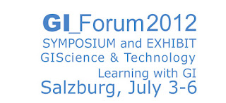
    GI Fórum 2012 : Tudomány, Technológia, Tanulás Térinformatikával


    GI_Forum 2012
    3-6 July, 2012, Salzburg, Austria
    GI_Forum 2012 offers full-fledged, intertwined tracks on GIScience & Technology and Learning with GI with a focus on geovisualization, society and learning, and their inter-relationships. The interdisciplinary GI_Forum focuses on an international audience, communicating in English, and sharing an interest in translating theory, methods and techniques into a broad range of GI application domains. Young researchers are especially invited to contribute and discuss their research; together with established scientists they will find a vibrant community from academia, business, and education to analyse progress and to explore new research directions. GI_Forum runs concurrently with the highly regarded German language conference on Applied Geoinformatics – AGIT (www.agit.at). The two symposia share the innovative AGIT EXPO exhibit and stimulating social events.
    Submission deadline February 1, 2012. More information: www.gi-forum.org, Contact: office@gi-forum.org


    Friday, October 28, 2011

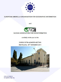
    EUROGI EMM - kibővített tagsági nap

    A felhívást ma reggel tette közzé az EUROGI főtitkára Catharina Bamps.
    EUROGI EMM - Kibővített Tagsági Nap
    Színhely: Pozsony
    Időpont: 2011. november 18
    Vendéglátó: SAGI (Slovakian Association for Geographic Information)
    HUNAGI  poszterrel, előadással jelentkezhet, de
    az elhangzó előadások kiválasztásában az EUROGI dönt.
    Várhatóan az elfogadott, de el nem hangzó előadásokról is kiadvány  jelenik meg.
    Részletek: http://www.hunagi.hu/G/doc/Agenda2011EMM.pdf
    További részletek: www.eurogi.org
    HUNAGI bátorítja tagszervezeteit és tagintézményeit adjanak visszajelzést a HUNAGI felé, amennyiben készek bemutatni  eredményeiket.
    Az utazási költségek a HUNAGI tagszervezetet terhelik, részvételi díj nincsen.

    Thursday, October 27, 2011

    Partnerszervezetünk az MLBKT 19 Kongreszusa Siófokon november 16-18 között

    OpenGeoGovData - testvérszervezetünk őszi rendezénye Bécsben

    További részletek, jelentkezés: http://www.ageo.at/anmeldung

    LIDAR konferencia november végén Salzburgban

    Mai postánkból:


    "LESS THAN 5 WEEKS TO GO - POINT CLOUD AND OPEN SOURCE DEBATE OPENS THE EUROPEAN LiDAR MAPPING FORUM 2011
    A major step forwards or will it damage the industry; should we be supporting Open Source as a way forward for LIDAR technologies? It could open doors to many – or will it result in the closure of a number of industry players and be too high a price to pay? Or consider Point Cloud Services; are these a way to dramatically improve services for customers or is this just evolving technology?

    Tuesday, October 25, 2011

    EU Űrstratégia Konferencia - ezen a héten még lehet jelentkezni


    Ezen a héten még lehet jelentezni az EU Űrstratgiája 4. Konferenciájára. Mai postánkból:
    “LAST WEEK TO REGISTER
    Deadline for registration: 31 October 2011.
    Please be reminded that the 4th High-level Conference on European Space Policy will be taking place on 8 & 9 November 2011 in the Hemicycle of the European Parliament in Brussels, Belgium.
    
Be sure to register before 31 October 2011. Registration via the Conference website is required and free of charge: www.spaceconference.eu
    The Conference will be interpreted in English, French, German and Italian.
    This Conference comes at a crucial time:
        a few days after the successful launch of the first two satellites of the future European satellite navigation system, Galileo, which took place on 21 October 2011,
        a few days after the launch by the European Commission of a new tender for additional Galileo satellites,  
        and at a time when the EU Institutions are negotiating the EU’s future Multiannual Financial Framework (2014-2020) (which will determine the timescale and conditions for the completion of the two flagship European space programmes, Galileo and GMES), and the support that is to be given, through the R&D framework “Horizon 2020”, to the development of new innovative space technologies and services.
    This event will provide the 700 participants already registered with a perfect opportunity:
        for discussion and debate on current and future EU space policy, its financing and governance, related EU industrial and innovation policy, and the benefits of space-based applications and services for European citizens and businesses, the fight against climate change and environmental degradation, combating security threats, etc.;
        for bringing together key political decision-makers, including representatives of national and European institutions and authorities, and representatives of industry, research centres and civil society.
    The event is organised in partnership with the European Commission Directorate-General for Enterprise and Industry, the Committee of the Regions, the European Space Agency, the European Parliament’s Sky and Space Intergroup, Eurospace and other key actors from the space and space-user sector.”

    Tuesday, October 18, 2011

    ICT Rendezvények

    Németh Edina (Nemzeti Innovációs Hivatal) mai postájából:

    ICT RENDEZVÉNYEK


    Okt.
24-28    Future Internet Week - Poznan, Poland
The next Future Internet Week will be held in Poznan - a series of conferences and exhibition organized by the Ministry of Science and Higher Education and the Poznan Supercomputing and Networking Center, in collaboration with the scientific community of Poznan. This event takes place in the semi-annual cycle, in the countries currently assuming the Presidency of the European Union.

Over 20 events to choose from! A few examples:            
                           Okt. 24.                            Future Internet Conference
                           Okt. 24.                            ENoLL - European Network of Living Labs
                           Okt. 25-26.                       FIA - Future Internet Assembly
                           Okt. 26-28.                       Service Wave 2011
                           Okt. 26-27.                       IOT - The Internet of Things
                           Okt. 26-27.                       ICT Clusters Forum
                           Okt. 26-27.                       FIRE Conference
    Okt.
25-26    ARTEMIS and ITEA Co-Summit 2011 - Cross Border Co-operation for Clean Technologies - Helsinki, Finland 
CO-SUMMIT 2011 is expecting over 650 participants from industry, academia, public authorities and press. This year's theme for this high level event is: Cross border challenges for clean technologies. ARTEMIS and ITEA will showcase over 75 cross border projects at the, including a focus area on clean technologies.                    
    Okt.
26-28    eChallenges 2011 - e-2011 - Florence, Italy 
eChallenges 2011 is expected to attract over 600 delegates. The goals of e-2011 are to promote ICT knowledge sharing and innovation between commercial organisations, government agencies and the research community, exhange experiences about the current state of eAdoption at a sectoral, national or regional level and stimulate rapid take-up of Research and Technology Development (RTD) results by industry and in particular SMEs.                     
    Nov.
11        IPTS – IT STAR International Conference - ICT Research and Innovation Challenges in Eastern European Member States (EEMS) - Budapest, Hungary 
Eastern EU Member States have very low ICT business expenditures in ICT R&D in relation to their GDP. They also show a very low rate of ICT public expenditures in R&D in relation to their GDP. Although several of them have recorded spectacular increases in ICT manufacturing employment, deeper analysis tends to indicate that these countries are still hosting rather low value added activities. 
The mission of this conference is to confront such facts and views to the testimony of the stakeholders from academia, industry and policy so as to validate the observations, interpret their possible meaning and opt for actions that might favorably influence the future.             
    Nov.
15        Digital Preservation and Access to Cultural Resources: ICT Call 9 Information Da - Luxembourg 
This event addresses researchers interested in submitting project proposals to the 9th ICT call under FP7, objectives ICT-2011.4.3 Digital Preservation and 8.2 Access to Cultural Resources. The information day aims at helping participants to better understand the work programme and criteria for the evaluation of proposals, to facilitate sharing of ideas and experiences, and to meet potential partners for project consortia.                 
    Nov.
15-16   European Nanoelectronics Forum 2011 - Dublin, Ireland 
The European Nanoelectronics Forum is organised by the Joint Technology Initiative ENIAC and the Eureka Cluster Catrene (Cluster for Application and Technology Research in Europe on NanoElectronics) in Dublin, Ireland. Invitations can be requested on the event website.                     
    Dec.
5-6           Innovation Convention 2011 - Brussels, Belgium 
The European Commission is holding its first Innovation Convention following the adoption of the Innovation Union Flagship initiative in October 2010. This major event will gather more than 1200 participants involved in the innovation chain, including high-level policy makers, leading CEOs, deans of universities and research centres, bankers, venture capitalists, top researchers and innovators.