Mai postánkból. Tagtársunk, Kákonyi Gábor adta tudtul, hogy az idei Fény-Tér-Kép 2014 konferencia 30 előadása közül 18 már elérhető és letölthető a GeoIQ weboldalán:
Tuesday, December 23, 2014
Sunday, December 7, 2014
Előadásjavaslatok küldhetők be adott témakörökben a 2015. évi Digitális Föld nagyrendezvényre.
Prof Dr. Hugh Millward (Dept. of Geography & Environmental Studies, School of the Environment, Saint Mary's University), a Digital Earth 2015 szervezőbizottsága elnöke küldte meg az alábbi első figyelemfelhívást a jövő októberi eseményre.

Call for Abstracts, Special Sessions and Workshops
Attention scientists, engineers, technologists, environmental managers and other stakeholders in Digital Earth: we welcome your participation in the Digital Earth 2015 Symposium as a presenter, and invite you to submit an Abstract of your proposed oral or poster presentation for consideration.
Under the banner "Towards a One-World Vision for the Blue Planet" this 9th Symposium of the International Society for Digital Earth (ISDE) will address five important themes relating to the interdisciplinary Digital Earth community:
Digital Earth 2015 seeks abstracts describing the state of the art and practice in these fields. We invite the submission of Abstracts for consideration by the Scientific Program Committee. Submissions for Special Session are also welcome.
Details on the Symposium can be found at the digitalearth2015.ca website, which also contains specific information on the Call for Abstracts, as well as details for the Call for Special Sessions and Workshops. Questions regarding the Symposium may be directed to info@digitalearth2015.ca. To continue to receive updates and information on Digital Earth 2015, select the “subscribe” link on the first page of the website.
Please forward this opportunity to your networks of interested stakeholders in Digital Earth. Thank you for your anticipated participation in this process.
Hugh Millward
Chair, Local Organizing Committee
Digital Earth 2015
Dirk Werle
Chair, Scientific Program Committee
Digital Earth 2015

Call for Abstracts, Special Sessions and Workshops
Attention scientists, engineers, technologists, environmental managers and other stakeholders in Digital Earth: we welcome your participation in the Digital Earth 2015 Symposium as a presenter, and invite you to submit an Abstract of your proposed oral or poster presentation for consideration.
Under the banner "Towards a One-World Vision for the Blue Planet" this 9th Symposium of the International Society for Digital Earth (ISDE) will address five important themes relating to the interdisciplinary Digital Earth community:
- Digital Earth Theory and Technology
- Earth Observation
- Digital Earth Applications
- Digital Earth and Citizen Well-being, and
- Digital Earth Education and Outreach
These themes offer a wide range of topics for discussion, and may be addressed through the prisms of the natural sciences, social sciences, engineering, management, or public policy. Inter-theme and interdisciplinary collaborations are encouraged, as are panel discussions and working-group meetings.Digital Earth 2015 seeks abstracts describing the state of the art and practice in these fields. We invite the submission of Abstracts for consideration by the Scientific Program Committee. Submissions for Special Session are also welcome.
Details on the Symposium can be found at the digitalearth2015.ca website, which also contains specific information on the Call for Abstracts, as well as details for the Call for Special Sessions and Workshops. Questions regarding the Symposium may be directed to info@digitalearth2015.ca. To continue to receive updates and information on Digital Earth 2015, select the “subscribe” link on the first page of the website.
Please forward this opportunity to your networks of interested stakeholders in Digital Earth. Thank you for your anticipated participation in this process.
Hugh Millward
Chair, Local Organizing Committee
Digital Earth 2015
Dirk Werle
Chair, Scientific Program Committee
Digital Earth 2015
Thursday, December 4, 2014
Nagyfelbontású optikai és SAR képek osztályozása - tudományos előadás a SZTAKI-ban
Postánkból: Prof. Szirányi Tamás kutatólboratórium-vezető írja a SZTAKI-ból:
"Prof. Josiane Zerubia lesz a vendégünk a jövő héten, az INRIA-ról (Sophia Antipolis).
11-én 10.30-kor szemináriumot tart a Kende Nagy Tanácsteremben, melynek címe:
"Supervised classification from high resolution optical and SAR images for natural disaster management"
Érdeklődés:
sziranyi (at) sztaki.hu.
 Az IEEE tag Zerubia asszonyt az Erthzine webes szaklap is bemutatja: http://earthzine.org/2009/07/27/la-vie-de-josiane-zerubia-a-very-modern-woman-of-science/
Wednesday, December 3, 2014
Az UAV piac 12 milliárd dolláros üzleti forgalmat hoz a következő 10 évben. A szabályozási környezet hiánya és a biztonsági félelmek gátolják a piac fejlődését.
Mai postánkból. A SPAR Point Group-tól érkezett az alábbi eseményfelhívás, melyet hazai időszerűsége miatt (Lisa Murray idézet) a HUNAGI közösége számára közreadunk.
Commercial UAV Expo Announced for October 2015
by SPAR Point Group, a division of Diversified Communications

Portland, Maine USA, December 3, 2014 - SPAR Point Group announced that it will launchCommercial UAV Expo, October 5-7, 2015 at Caesars Palace, Las Vegas, Nevada. As organizers of premier 3D technology events in North America, Europe and Asia, SPAR Point Group is well established in the data capture and imaging technology space. "We have been listening to our customers and watching the market for some time," said Lisa Murray, Director. "While it is well known that the Unmanned Aerial Vehicle (UAV) is a game-changing technology, the regulatory environment and concerns over safety have kept commercial growth to a minimum. Given the potential benefits of approved commercial UAV use and global market projections of $12 billion for commercial UAVs over the next decade, the time is right to launch this event."
Industry agrees. Topcon's Director of Geospatial Sales, Dave Henderson said, "Moving forward, it is vital that the industry has an event dedicated to commercial UAV use. SPAR Point Group is uniquely qualified to host such an event given their history and expertise delivering top notch business and technology events for 3D precision measurement and imaging. They already have established relationships with providers and potential users in key market sectors eager to integrate UAV systems."
"We are excited to connect the UAV community with potential customers in surveying and mapping, civil infrastructure, mining, construction, process, power & utilities, precision agriculture, law enforcement, security and emergency response," said Ms. Murray. "These are natural markets for Commercial UAVs, and ones in which we have established contacts. Seasoned professionals in aerial, mobile and terrestrial data capture technology are particularly interested in the business benefits UAVs provide, including potential cost savings, ease of use, immediacy of data delivery and increased accessibility."
Commercial UAV Expo will feature an exhibit hall of UAV manufacturers, component and sensor manufacturers, software providers and service companies. Organizers expect upwards of 1,000 attendees and 80 exhibits in 2015. Las Vegas was selected for proximity to key players on the West Coast and an affordable and accessible location for the entire market. A two-day conference program will feature programming tracks including commercial applications, hardware and software options, cost considerations, the regulatory environment and data management and integration.
"In speaking with providers in the UAV sector, it is clear an event focused on industries suited to small UAVs is needed," said Ms. Murray. "While the overall UAV sector is currently dominated by defense and military applications, it is hard to imagine any industry that will not be affected by UAV adoption. Our customers rely on our technology events to deliver the latest innovations on the market. They want to see what's new and what's next. Clearly, what's next is the UAV, and we are excited to showcase this next wave of innovation at Commercial UAV Expo next year."
For more information, visit expouav.com or contact Lisa Murray, Director. Tel: 207-842-5468;lmurray@divcom.com
About SPAR Point Group
SPAR Point Group organizes conferences and provides news and information for professionals involved in 3D measurement and imaging technologies. Content- delivered in-person and online- gives practitioners tools and information to make better business decisions. SPAR Point Group organizes Commercial UAV Expo, SPAR Europe, European LiDAR Mapping Forum, SPAR International, International LiDAR Mapping Forum and SPAR Japan. SPAR Point Group is wholly-owned by Diversified Communications. For more information, visit www.SPARPointGroup.com."
Tuesday, November 4, 2014
18. AGILE Konferencia 2015-ben Előadásbekérés
18th AGILE Conference on Geographic Information Science: “Geographic information Science as an enabler of smarter cities and communities”
9-12 June 2015
Lisboa, Portugal
Call for Papers
On behalf of the AGILE council, we invite you to participate at the 18th AGILE International Conference on Geographic Information Science, scheduled to take place in Lisboa, Portugal.
The program will offer parallel paper presentation sessions, keynote sessions, poster sessions and pre-conference workshops to share your ideas, explore on-going research, future developments, including state-of-the-art applications, and to network with the professionals from academia, industry, and government who are interested in promoting GI teaching and research activities among GI laboratories at the European level.
Potential contributors are invited to submit:
- Full-paper submission (maximum 6000-word manuscript) of original and unpublished fundamental scientific research. High-quality scientific submissions will be accepted for presentation at the conference and published in the Springer Lecture Notes on Geoinformation and Cartography. We especially encourage PhD students to submit full papers. Papers must be written in English according to the Springer formatting guidelines.
Note: AGILE 2015 is running a blind review process. In preparing your manuscript, do not include any information which could reveal your identity, or that of your co-authors. The title section of your manuscript should not contain any author names, email addresses, or affiliation status. In the body of your submission, you should eliminate all direct references to your own previous work. That is, avoid phrases such as "this contribution generalizes our results for XYZ". Also, please do not disproportionately cite your own previous work. In other words, make your submission as anonymous as possible. We need your cooperation in our effort to maintain a fair, blind reviewing process.
- Short paper submission (2000 to 3000-word manuscript) of original and unpublished research work. High-quality scientific and strategic (industrial and governmental) submissions will be accepted for presentation at the conference and published in the AGILE proceedings volume (with ISSN). Papers must be written in English according to the submission template and formatting guidelines.
- Poster submission (500 to 1000-word manuscript) of original scientific and strategic research work. High-quality submissions will be accepted for poster presentations at the conference and provide the exceptional opportunity to stimulate scientific discussions and exchange novel ideas. Papers must be written in English according to the submission template and formatting guidelines.
Conference Topics
Contributions are invited on all topics within the fields of geoinformation, geomatics and geocomputation, including (but not limited to):
- Smart cities
- Geosensors Networks and Sensor Web
- Big Spatial Data: Analysis and Visualization
- Earth Observation Systems: Algorithms and Applications
- Volunteered Geographic Information and Community Observatories
- Crowdsourcing, Co-creation and Participatory GIS
- Data Mining and Knowledge Discovery
- Data and Information Integration and Fusion for Big Data
- Awareness, Representation and Analysis of Locations, Places and Geographic Phenomena
- Linked Open Data, Spatial Semantics and Spatiotemporal Ontologies
- Spatiotemporal Data Acquisition, Modelling, and Analysis
- Uncertainty and Error Propagation
- 3D Modelling, Analysis and Visualization
- Location Based Services and Mobile GI Applications
- Geospatial Decision Support Systems
- Model Web, Geospatial Workflows and Service Composition
- Spatial Data Infrastructures: Data and Service Sharing
- Digital Earth, Virtual Globes and Spatial-oriented Augmented Reality
- Future Internet, Ubiquitous Web and Geographic Information Systems
- Cognitive Aspects of Human-Computer Interaction for Geographic Information Systems
- Geodesign and Simulation
- Location Based Services, Geospatial Services and Real-time Applications
- Indoor Navigation, Routing and Way Finding
- Smart Cities and Sustainable Development
- Environmental/Ecological and Urban/Regional Modelling
- Demographic and Socioeconomic Modelling
- Natural Resources Management and Monitoring
- Disaster and Risk Management
- Socio-Economic Impact Assessment of Geographic Information
- GIScience and Technology Education and Training
- Digital (Geospatial and Environmental) Science
- Full paper submission: November 30th 2014
- Pre-conference workshop proposal: November 24th 2014
- Notification of workshop acceptance: December 19th 2014
- Notification of full paper acceptance: January 12st 2015
- Camera-ready full paper copies due: January, 26th 2015
- Short paper and poster submissions: January 30th 2015
- Notification of short paper and poster acceptance: March 5th 2015
- Camera-ready short paper copies due: March 29th 2015
- Early registration: March 31st 2015
- Conference: June 9th – 12th 2015
Maribel Yasmina Santos
Secretary-General AGILE
João Galvão
External Officer for AGILE Secretary
Association of Geographic Information Laboratories in Europe
http://www.agile-online.org
agile.secretary@gmail.com"
Secretary-General AGILE
João Galvão
External Officer for AGILE Secretary
Association of Geographic Information Laboratories in Europe
http://www.agile-online.org
agile.secretary@gmail.com"
Wednesday, October 29, 2014
GI_Forum 2015 – Geospatial Minds for Society. Rendezvény Salzburgban 2015. július 7-10 között
GI_Forum 2015 – Geospatial Minds for Society
 Ms. Simone Dürr (University of Salzburg, Dept of Geoinformation Z_GIS) tájékoztatása alapján tesszük közzé a következő figyelemfelhívást: "The GI_Forum 2015 provides a platform for dialogue among geospatial minds in an ongoing effort to support the creation of an informed GISociety. Bearing in mind different perspectives from a variety of professions, presentations, workshops and exhibitions will concentrate on innovations in education, science and technologies, in the spatial domain and their possible contribution to a more just, ethical and sustainable society. Prominent keynote speakers will highlight new developments, offer insights into trends and visions, and at the same time be available for our Young Researchers' Corner for more individualized interaction with young researchers.
GI_Forum 2015 | July 7-10, 2015 in Salzburg | www.gi-forum.org
July 7 – 10, 2015 | Salzburg, Austria
GI_Forum runs concurrently with the highly regarded German language conference on Applied Geoinformatics – AGIT (www.agit.at). The two symposia share some 1200 participants, the innovative AGIT EXPO exhibit and stimulating social events.
Submission deadline February 1, 2015. More information: www.gi-forum.org, Contact: office@gi-forum.org."
Get connected: 


Monday, October 27, 2014
ELF: Webes szeminárium az European Location Framework együttműködésről

2014 október 31
European
Location
Framework

Jelentkezés itt:
 GeoSUR is a regional initiative led by spatial data producers in Latin America and the Caribbean to implement a regional geospatial network
November 4: EU Space Imaging ankét a FÖMI-ben MFTTT-GeoIQ szervezésben
Mai postánkból . Kákonyi Gábor tagtársunk, a GeoIQ cégvezetője írja körlevelében: "Mivel az EU Space Imaging nem tudott részt venni az idei Fény-Tér-Kép konferencián egy másik rendezvény miatt, így elhatároztuk, hogy rendezünk egy olyan napot, amikor csak az ő szenzoraikról lesz szó.
A DigitalGlobe WorldView-3 műholdjának 30 cm-es terepi felbontása jelenleg a legjobb a kereskedelmi műholdak között.
Így tehát november 4-én kedden 10.00 órakor a FÖMI első emeleti tanácstermében, (Cím: Budapest Bosnyák tér 5) EU Space Imaging/DigitalGlobe Napot tartunk.
Az előadó, Pascal Schichor Münchenből érkezik az EU Space Imaging ottani irodájából.
Az előadásának a címe:
DigitalGlobe’s WorldView Satellites and their unprecedented level of Resolution and Accuracy with Superspectral Bands.
Introducing the new Skybox constellation: Multiple revisit for instant tasking.
Addig is ajánlok egy webcímet annak eldöntésére, hogy mit is jelent a „Superspectral”, 27 csatornát vagy pontosan mennyit is:
A Skybox-al kapcsolatban is ajánlok egy előzetes ismertetőt, 24 műholdat terveznek feljuttatni a közeljövőben, s a felbontás méter alatti, no és video-t is képes rögzíteni az űrből:
A rendezvény az MFTTT távérzékelési szakosztálya és a GeoIQ kft. közös rendezvénye.
A részvétel ingyenes.
A részvételi szándékot kérjük egy rövid emailben jelezze, hogy jól tudjuk „kalibrálni” az ásványvíz és kávé/pogácsa mennyiségét. No és a terem is maximum 40-50 fő befogadására képes.
Várunk mindenkit szeretettel.
Üdvözlettel,
Kákonyi Gábor
GeoIQ kft.
2098 Pilisszentkereszt, Kakashegy utca 56"
Friday, October 24, 2014
3. Nyílt forráskódú térinformatika munkaértekezlet
Dr. Siki Zoltán, a HUNAGI főtitkár-helyettese (BME ÁGT), a rendezvény szervezője írja mai levelében:
http://www.agt.bme.hu/gis/
Köszönjük azoknak, akik már regisztráltak!
Önre és a téma iránt érdeklődő kollégáira, ismerőseire is számítunk."
Ízelítőül az előző évi 2. Nyílt forráskódú térinformatika munkaértekezlet képei (HUNAGI fotók).
"A munkaértekezlet egyre bővülő előzetes programja érhető el a honlapunkon:
http://www.agt.bme.hu/gis/http://www.agt.bme.hu/gis/
Köszönjük azoknak, akik már regisztráltak!
Ízelítőül az előző évi 2. Nyílt forráskódú térinformatika munkaértekezlet képei (HUNAGI fotók).
Thursday, October 23, 2014
HUNAGI az Infotér 2014 Konferencia szakmai támogatója
Barkóczi Zsolt elnök vezetésével 2014. október 28-án ülést tart az Infotér 2014. Konferencia (Balatonfüred, 2014. november 5-7) két térinformatikai szekcióját szervező HUNAGI Munkacsoport. A testület illetékes a Mobilalkalmazások fejlesztésére kiírt pályázat pályaműveinek értékelésére is. A térinformatikai szekciók megszervezése és lebonyolítása a Nemzeti Hírközlési és Informatikai Tanács és HUNAGI kezdeményezésére
történik NMHH-HUNAGI Együttműködési Megállapodás keretében.
Az 5. alkalommal rendezett kormányzati infokommunikációs konferenciát szervező Infotér Egyesület az egyik szakmai támogatójának választotta a HUNAGI-t. Az első egyeztetésre még augusztus végén került sor.
A konferencia programja itt tekinthető meg.
Az Infotér szervezésében a rendezvény szponzorai között találjuk a HUNAGI közösségéből a következő vállalkozásokat: Esri Magyarország, Hexagon Geospatial, Intergraph, Magyar Posta, NetVisor...
történik NMHH-HUNAGI Együttműködési Megállapodás keretében.
 |
| Kép forrása: Infotér weboldal |
A konferencia programja itt tekinthető meg.
Az Infotér szervezésében a rendezvény szponzorai között találjuk a HUNAGI közösségéből a következő vállalkozásokat: Esri Magyarország, Hexagon Geospatial, Intergraph, Magyar Posta, NetVisor...
IGIT 2015. Integrált geoinformációs technológiák és alkalmazásaik a GEOSS megvalósítása irányában
IGIT 2005 nemzetközi konferencia
Székesfehérvár, 2015. január 16-17
Bővebb információ: www.geo.info.hu/igit
 Az IGIT rendezvény célja egy prototípus rendszer jelenlegi fejlesztésének bemutatása adatgyűjtéshez, elemzéshez és terjesztéshez a döntéshozók felé; egy lépés a GEOSS kezdeményezés felé. A célterületek: képfeldolgozási technikák a távérzékelésben, mezőgazdasági-, föld- és környezeti monitoring, vízi erőforrás-gazdálkodás, földrajzi tudáshálók, klímaváltozás és partvidéki gazdálkodás. A magas színvonalú tudományos rendezvényen többek között nyolc kiváló nemzetközi intézmény és műhely képviselői vesznek részt köztük a GEO Titkárság (Genf), a RADI (Peking) vagy az ITC (Enschede). A rendezvény házigazdája az Óbudai Egyetem székesfehérvári GEO kara, amely nevében már előbb volt GEO, mint ahogy a kormányok a GEO kezdeményezést létrehozták...
Székesfehérvár, 2015. január 16-17
Bővebb információ: www.geo.info.hu/igit
Regionális FOSS4G konferencia Ázsiában európai vezérelőadóval

Bangkok, Thailand, 2-5 December 2014.
Bővebb információ: http://www.foss4g-asia.org/
A konferencia egyik vezér-előadója Prof. Maria A. Brovelli (PoliMi Como), a jövő évi FOSS4G Európe házigazdája lesz. A nyíltforrású szoftverek a térinformatikában tárgyú como-i konferenciára remélhetőleg a magyar szakemberek hasonlóan népes közössége vesz majd részt mint Brémában, az első ilyen európai konferencián. Az ázsiai rendezvény anyagainak tanulmányozása különösen számukra lehet hasznos.
Tuesday, October 21, 2014
Előadásjavaslatokat vár a HUNAGI az EURISY Regionális Műhelyére
Információ az EURISY weboldaláról:
 "11 December 2014 | Debrecen, Hungary
Spatial planning and geoinformation services for regional development
read more >
- See more at: http://www.eurisy.org/events.php#sthash.9dbV36oQ.dpuf"
Az EURISY részére a HUNSPACE és HUNAGI javaslatokat tehet potenciális előadókra, ezen felül a rendezvény hallgatóságába tagjaikat és partnereiket is mozgósíthatják.
Érdeklődés esetén írjanak a hunagi@hunagi.hu címre.
Spatial planning and geoinformation services for regional development
This workshop will allow these regional stakeholders to learn about and evaluate the potential of geospatial information, of innovative location and navigation-based services to boost the regional economy through more innovative public services, closer partnerships with SMEs, and an increased capacity for the region to attract EU funds and investments in its key sectors.
- See more at: http://www.eurisy.org/events.php#sthash.9dbV36oQ.dpuf"
Az EURISY részére a HUNSPACE és HUNAGI javaslatokat tehet potenciális előadókra, ezen felül a rendezvény hallgatóságába tagjaikat és partnereiket is mozgósíthatják.
Érdeklődés esetén írjanak a hunagi@hunagi.hu címre.
Big Data from Space - BiDS'14 konferencia Frascatiban
 |
| A kép forrása: itt |
A CEOS WGISS levelezésében érkezett a hír Mirko Albani (ESA ESRIN) úrtól
"2014 Conference on Big Data From Space (BiDS’14):
A magyar űripar HUNSPACE által szerkesztett kiadványa, amely a földmegfigyelési szolgáltatásokról is áttekintést ad a FÖMI, OMSZ, Geoadat Kft és az Infoterra Magyarország (Airbus Defense & Space) tevékenysége bemutatásával. A kiadvány a WGISS-38-on tett ígéret nyomán ezekben a napokban kerül a HUNAGI-n keresztül Albani úr asztalára.
Monday, October 20, 2014
Megváltoztatták a XI. GEO plenáris ülés helyszínét és időpontját

UAV, UAS rendszerek polgári használatban - nemzetközi konferencia Párizsban 2014 november 14-14.

"Please find below the invitation for the upcoming international conference AAE is organising on 13-14 Nov in Paris on Present and future of civilian RPAS with the sponsorship (among others) of UVSi and FPDC. "
Saturday, October 18, 2014
Európai védelmi célú térinformatikai konferencia Stockholmban.
Mai postánkból. Prof.Dr.habil. Dunkel Zoltán, a Magyar Meteorológiai Társaság elnöke tájékoztatja a HUNAGI közösségét:

"2014. november 18-19, Stockholm.
Európai védelmi célú térinformatikai konferencia Stockholmban.
Rendezvényprogram:
Szervezi: Corinium Global Intelligence
Érdeklődés: enquiries@
A szervezők felkérésére, a HUNAGI közvetítével a rendezvénynek magyar előadója is lesz az MTA SZTAKI műhelyéből:
Dr. Andras Majdik, Research Fellow, INSTITUTE FOR COMPUTER SCIENCE & CONTROL OF THE HUNGARIAN ACADEMY OF SCIENCES
A szervezők felkérésére, a HUNAGI közvetítével a rendezvénynek magyar előadója is lesz az MTA SZTAKI műhelyéből:
Dr. Andras Majdik, Research Fellow, INSTITUTE FOR COMPUTER SCIENCE & CONTROL OF THE HUNGARIAN ACADEMY OF SCIENCES
Monday, October 13, 2014
HUNAGI és a HUNSPACE az INNOTRENDS 2014 Konferencia Űripar és versenyképesség szekciójában

2014. október 17. 11:25-12:55
Témakör és programa Nemzeti Innovációs Hivatal honlapján: http://www.nih.gov.hu/innotrends/program/uripar-versenykepesseg
Sunday, October 12, 2014
DGI 2015, London. Térinformatika a védelem és biztonság szolgálatában
HUNAGI mai postájából. Roger Longhorntól a GSDI körlevelével érkezett:
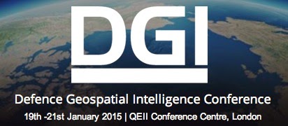 "Dear Colleagues,
In a survey sent out to over 1000 government and military agencies, 85% consider GIS and Technology development a priority for their organisation.
It’s no wonder. As new terrorist states continue to emerge using misinformation and popular media for maximum disruption, quick and secure transformation of information into finished intelligence has become a number 1 priority for the world’s geospatial experts and their user communities.
DGI, Europe’s largest conference covering location intelligence- has developed a key agenda that focuses on the challenges brought forward from research over the last 6 months.
To see some of the Key Highlights read on below or for more detail download the agenda here:http://wbresear.ch/gsdiagenda
19th January at 12.20: Challenge the experts - what are the new requirements, what are the solutions - In this panel with Jim Hill, Marine Corps Intelligence, CDR Kelly Taylor, US National Ice Center, Martin Jeffries, Office of Naval Research and more you will receive new ideas from leading US and Canadian geospatial intelligence experts plus ask questions yourself
19th January at 14.20: How Interoperability Between Geospatial Intelligence And The MAJIIC Project will be Achieved During 2015 – Learn from NATO and NCIA about how they are breaking down the silos for increased collaboration between forces, in order to tackle threats more efficiently.
20th January at 10.00: 5 Challenges Geospatial intelligence Leaders Need to Overcome – Spend time with some of the world’s most experienced geospatial intelligence leaders to understand how they prioritise activities in response to the biggest challenges today during this unmissable panel!
21st January at 8.40: Geo-Political Changes Shaping the Future for Location Intelligence Professionals – The onset of cross border and home grown terrorists is a new challenge and threat which has multiple implications. Find out what measures have been put in place to reduce these threats from world-renowned expert Robert B. Murrett Deputy Director, Institute for National Security and Counterterrorism (INSCT) Professor of Practice, Public Administration and International Affairs.
If you are interested in finding out more about this event then download the agenda today here:http://wbresear.ch/gsdiagenda
I will be at DGI from 19th to 21st January 2015, and I look forward to seeing you there!
Kind regards
Neil Thompson
Former Director, Geospatial Intelligence Canadian Armed Forces
Advisor, Defence Geospatial Intelligence
GSDI-All mailing list
GSDI-All@lists.gsdi.org
http://lists.gsdi.org/mailman/
HUNAGI bátorítja tagjait és partnereit, olvassák a GSDI szervezet híranyagait: www.gsdi.org
Subscribe to:
Posts (Atom)